DAYS 11-12 "THE END IS WHERE WE START FROM" t.s.eliot
Day 11 We started at Cook County Rd 45, would go to the first campsites, a scratch under 7 miles, arriving before nightfall. As it turned out this section was a piece of cake.
We had 1000 ft of elevation in the first couple of miles on this incredibly smooth trail surface. These were climbs a hiker could trust. When the top was reached, the top was reached. There wasn't more incline hiding behind the next vegetation- covered curve.
If I were to describe this section I might use commonly known Route 66 nicknames like The Mother Road, or The Main Street of America. We cruised along like we were on a super highway. The trail surface was smooth and often soft. Yes there were, what Caleb called, 'speed bumps' along the way where customary rocks and roots slowed the pace, but he said they were there just to keep a hiker awake and alert. 😂
It was a beautiful section, one Marci would have done backflips to have covered. The thought of how runnable this section would be was a big part of our conversation through his magical place. It totally would be a blast to run.
We hiked a few miles through tall and extensive stands of straight-as-an-arrow red pine forests. The ‘understory specialists’ in this part of the forest were the edible Bunchberry plants (best when dried to make Bunchberry raisins, so I’ve read) with their bright green leaves and Christmas-red berries, mixed with the mildly toxic but standing-at-attention Bluebead Lily. They simply ask the passerby for admiration; these small low growing perennial plants politely slow any pace to a standstill.
We talked and hiked for just under 2.5 hours, the shadows were getting longer, the forest darker and the setting sun an orange sphere, when we came to South Bally Creek Pond. We passed it by to inspect its sister site across the pond, North Bally Creek Pond.
We walked into the camp to find hikers had already set up housekeeping, had a fire burning, tents up, food prepped and currently being eaten. The North Bally Creek site is small, 2-3 tent pads, and the best of the pads had been taken. So after chatting up the hikers a bit we opted to move over to the South campsite.
The best part of having checked out the North site first was I met back up with 13 yo Conner. It was an unexpected reunion and we were both really happy to see one another again. We'd met days before on the trail near Lookout Mountain. He was hiking alone at that time. We exchanged our real names, talked about our trips for quite a bit then he just...(poof) seemed to disappear...literally disappear back onto the trail in the direction he'd just come. Being a "now you see him, now you don't" kind of situation I had to ask myself was this real? Did I meet that guy and really talked to him? 😂
At any rate, he was in the campsite with his 17 yo brother, Austin, and was eating a Mountain House freeze dried chicken alfredo meal out of the bag. Score! He was real. They'd been on trail for 16 days and were doing the Traditional Hike from Martin Road to the Northern Terminus. I wouldn't see him again, but I doubt I'll forget him. His parents must be pretty special people ...allowing their two boys to do this ambitious and hard thing together.
We scooted over to the medium sized South Bally Creek Pond site with 5-6 tent pad choices and were pleased with our choice.
We got set up in a flash. Caleb is sooo efficient. He uses only a tarp (normally used with camping hammocks), a ground cloth and his bag. My tent takes less than 5 minutes. A fire was roaring, water was filtered from the (questionable) pond and the stove was boiling water in no time. We (actually mostly Caleb) ate spaghetti as the night solidly fell. It was just us and the relenting chorus of mosquitoes buzz-buzz-buzzzzzzzzzing around our heads. Did you not use bug dope?! you ask with a gasp. Absobloodylutely we did. ...they just didn't care.
I like smooth. So it was with some reservation I put my tent on the smoothest pad in the place because it happened to be closer to the pond. I knew there'd be a penalty flag thrown for this choice; I'd be colder as the night drew on and the air temp from the pond moved over land in my direction. And I was (the only night I was cold). Caleb, on the other hand was far too toasty for his liking up on the hill.
DAY 12
Morning broke on day 12, we drank coffee as per usual and nibbled something to get us going and were solidly hiking by 8:30, to cover the 9 miles we had to cover. We figured we'd be in by 11:00ish. The boys at North Bally Creek, however, seemed to be sleeping in today.
We passed by Sundling Pond and Creek. Caleb filtered water here. A small beaver dam, allowing a gentle trickle of water to release from the pond, rests next to the walkway/bridge around the pond. This brand spanking new, industrial quality, built-to-last-into-infinity, bridge and landscaped stairway allows the hiker to pass with supreme ease. The workmanship was top-notch. Due to the northwesterly winds, the Canadian forest fire smoke painted the sky a soft pink and the sun a dainty, barely-there orange this morning.
This next section of trail was equally as nice as the section the day before but with less climbing. We walked through more red pine forests, birch and quaking aspen stands (my personal favorite...I'm a Colorado girl by birth🤷♀️) all with carpeted forest floors
of verdant flora. We met Phil, a long-bearded, personable middle-aged father of a 13 yo daughter from Brainerd, who was doing the Through Hike to the Southern Terminus. He'd started only two (2!) days prior and was on mile 54 (54!) He.was.moving! He advised us of the transitioning trail ahead with its tall wet and heavy grass, sometimes muddy sections and narrow trail barely wide enough for a footfall. This trail surface would stay with us for about three miles and was drudgery. We recognized this section as a snowmobile trail in its ‘other season’, and is in full exposure of the sun. We crossed the Northernmost and Southernmost USFS115F Road crossings, the North Shore State Trail junction and the Old Ski Hill Road where we stopped, enjoyed some cool shade and took in some calories.
With a bit more than 2 miles ahead of us we descended abruptly down the face of the bluff we'd be hiking along as we neared the Gunflint Trail, which is an asphalt covered road. The trail surface at this time became largely loose rock upon solid rock making each step worthy of careful consideration, but our pace wasn't hampered. The closer we got to my trail terminus, I felt stronger and weaker both at the same time. The end was approaching and I was excited and reluctant both at the same time. I wanted to see it and I didn't want to see it both at the same time.
The trail quickly transitioned again to a smooth, narrow steep path depositing us on the Gunflint Trail asphalt road. A couple of cars sped past one in each direction then we zipped across, found the continuation of the trail and were off - back into the mixed soft and hardwood forest where the road noise was muffled. The rocky and rooty trail was a fickle one, it wove and wandered as it does so well, undulating up and down with every tiny rock filled creek crossing tucked down into steep banks, most absent of water. I saw, climbed down and back up out of a lot of these little creek crossings while on trail.
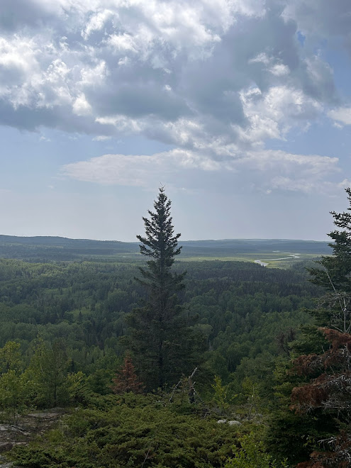
(It felt like without warning) we began climbing to Pincushion Mountain parking lot where we would find the vista view of Lake Superior, level ground, my trail terminus, and a place to begin again. The climb felt hard as the sun poured down and the breeze stood still and silent. We traveled over great slabs of ancient volcanic rock enlivened with lichen and tiny wildflowers who had found tiny footholds in tiny fissures on these huge slabs. Caleb remarked how this land is the land of the Keweenaw and we could as easily be there as here.
We kept moving but the couple of miles seemed to stay the same. The section was not a difficult, cantankerous one at this point, it was simply more of the same and it was saying, "...you are not done yet. You will climb to end this journey; "the end is where we start from."(t.s.eliot) It wasn't hard but it had a perception of "hard" to me at this point. It was hard because I was realizing I'd soon see the end, or what I perceived at that time as the end.
I needed a voice. I needed a voice to tell me to keep going. Caleb was the perfect voice and I wanted and needed to hear his voice now. He was there right behind me with all the encouragement and advise of a solid pacer.
So with one last, humungous push I popped out on top of the world. We'd made it, I'd made it. A punctuation mark was put. The journey was complete. my trail terminus was reached. It had ended and it was beginning.
"What we call the beginning is often the end.
And to make an end is to make a beginning.
The end is where we start from." t.s. eliot (Little Gidding) fourth quartet 


Hello Kate!! I so enjoyed your hiking journey!! What an incredible accomplishment and such joy to enjoy the views and experience of hiking and camping! I didn't know you blogged also!
ReplyDelete